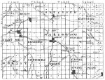
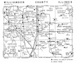
This map captures current active towns and villages, railroads and creeks that existed in 1905. It was published in the 1905 Souvenir Book. Note that there were 14 precincts then instead of 12. Western, Northern, Saline and Rock Creek precincts no longer exist and Union is now Southern.
Category Archives: Maps
A Pictorial History of Williamson County
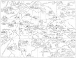
The Nannie Gray Parks map of Williamson County, Illinois, as the county existed in 1839 when it was created from the southern half of Franklin County, has been called Nannie Gray Parks’ greatest achievement by Homer Butler, who for many years wrote a column called “Glances at Life” which appeared in the Marion Daily Republican newspaper, and which served to remind us so often of our county’s colorful, sometimes riotous, history, is also responsible for calling the map a pictorial history of Williamson County’s early years. Continue reading
“The coming of the “hard” roads to Southern Illinois in the 1920’s, some called it “coming out of the mud” — was a mixed blessing. Continue reading
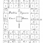
Marion was located and name August 20, 1839 by three commissioners from nearby counties appointed by the legislature. Continue reading


