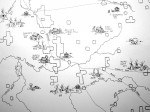
Map drawn up from Nannie Gray’s 1939 map by Ron Emery, isolating which areas of the county early pioneers established themselves and indians, predominently Shawnee, inhabited and lived. Continue reading
Marion Illinois History Preservation
Saving Marion's History Today for Tomorrow

