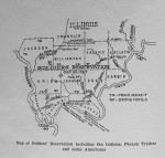
 At the close of the Revolutionary War, a great many soldiers were discharged and sent home without their pay. To remedy this, the Continental Congress passed an act granting to every such discharged soldier one hundred acres of land, to be selected by him within a prescribed territory; and on October 22nd, 1787, that congress set off as a reservation for that purpose, a portion of land in the Northwest Territory, described and bounded as follows: Continue reading
Tag Archives: map
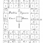
Marion was located and name August 20, 1839 by three commissioners from nearby counties appointed by the legislature. Continue reading


